
“With the Roads, Distances, Limits and extent of the Settlements, Humbly Inscribed to the Right Honourable the Earl of Halifax, and the other Right Honourable the Lords Commissioners for Trade and Plantations by Their Lordships most Obliged and Very Humble Servant, John Mitchell”
John Mitchell’s map was the only map consulted during the negotiations preceding the Treaty of Paris in 1782-1783. Several editions of the map were annotated with boundary lines marked in red ink. In 1934, Col. Lawrence Martin, then chief of the Library of Congress Geography and Map Division, called Mitchell’s map, “the most important map in American history.”
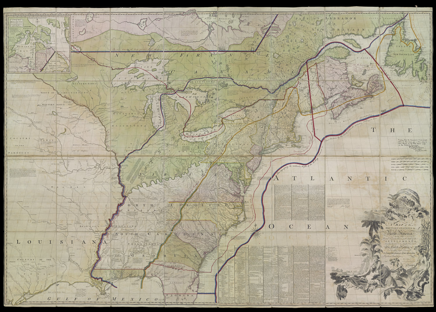
John Mitchell
A Map of the British Colonies in North America
1775
Copper Engraving
Osher Collection
This map was one of the first to be published after the American Revolution. It presents the former colonies, early settlements, forts, Indian villages and fishing banks.
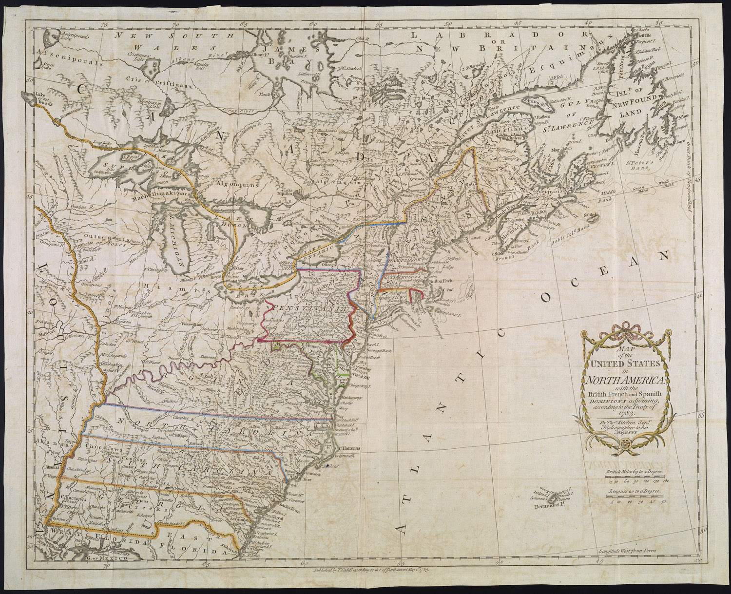
Thomas Kitchin
Map of the United States in North American with the British, French and Spanish Dominions adjoining, according to the Treaty of 1783
London, 1783
Copper Engraving
Osher Collection