Imaging Services
The Osher Map Library and Smtih Center for Cartographic Education is currently engaged in digitizing their rare map, atlas and globe collections, and all images are to be made accessible to the public as soon as possible via OML's website oshermaps.org
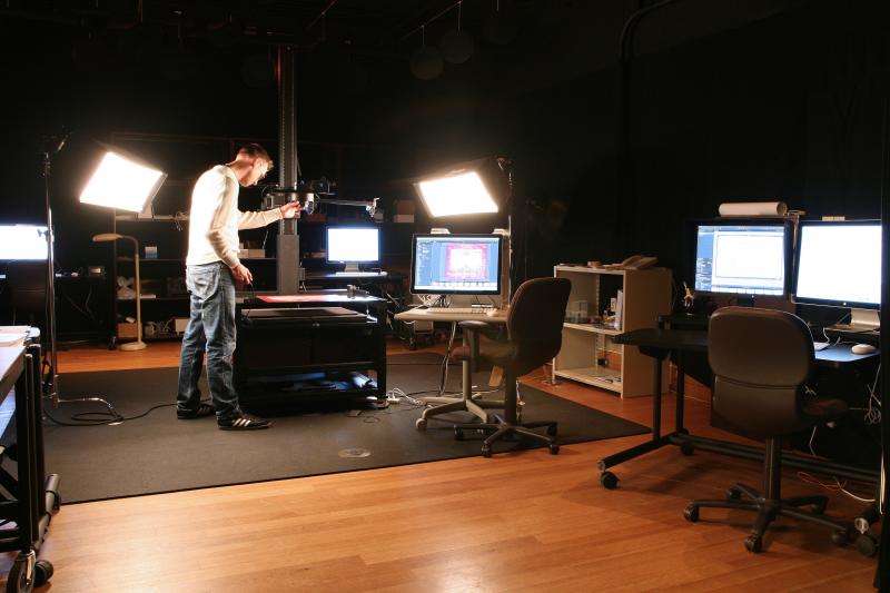
Established 2009, the Digital Imaging Center hosts an array of state-of-the-art imaging equipment making it possible to capture and document the collections rare materials. This equipment includes:
- The Phase One P65+ camera stand. A 60-megapixel camera stand that is used to capture the large and oversized rare maps and atlases.
- The Nikon D800e camera stand. A 36-megapixel camera stand that is used to capture the smaller to medium sized rare maps and atlases.
- The Nikon D810 camera. A 36-megapixel camera dedicated to the Ortery 3D imaging equipment for digitizing OML's rare globes and scientific surveying equipment.
The Digital Imaging Center follows the federal and international imaging guidelines of FADGI (Federal Agencies Digitization Guidelines Initiative) and the European Metamorfoze Standards. Project and device dependent all images are archived in the Adobe RGB (1998) or eciRGB v2 color space, with 300-600 ppi resolution.
Imaging services are offered to the public and to other cultural institutions who wish to have their material(s) imaged for a nominal fee.
Ownership of Digital Images
Images created for the Osher Map Library on behalf of the University of Southern Maine maintains the Creative Common License (http://creativecommons.org/licenses/by-nc-sa/4.0/). All low-resolution images are freely available on the website, and are scaled down to 1500 pixels wide in the jpeg file format. This scale and format is suitable for PowerPoint or other forms of scholarly presentations.
High-resolution images are freely available for scholarly and research purposes only, simply submit the required request form. Those wanting access to images intended for commercial purposes must seek approval from the Director, pay the required fee (if applicable), and the image(s) used must be attributed to the Osher Map Library.
Prices For Imaging Services
The Digital Imaging Center offers charges the following prices for their services to the public who are interested in OML’s digital images for personal or commercial purposes.
For OML’s digital images.
Maps, atlases and globes that have been digitized and are available on oshermaps.org: $35.00
Maps, atlases and globes that have NOT been digitized and are NOT available on oshermaps.org: $75.00
The Digital Imaging Center offers their imaging services to the public and to cultural institutions (historical societies, museums, libraries, etc.). The digital imaging team is trained to handle rare materials of various mediums (paper based, painting, etc.), and the rare items can temporarily be housed in OML’s state-of–the-art storage facility if necessary during the digitization process.
To book the Digital Imaging Center for the whole day (i.e. for large quantities of rare materials for digitization):
$350.00 all day
To image a single or a specified amount of items:
$50.00 per image/item
Post-production work
For any images that the customer would like to have edited for there purposes (i.e. basic Photoshop color and tone adjustments, stitching, or other adjustments) the DIC will charge an additional hourly fee of:
$45.00 per hour
Please contact to setup an appointment:
David Neikirk Adinah Barnett
Digital Imaging Coordinator Digital Imaging Associate
david.neikirk@maine.edu adinah.barnett@maine.edu
207-780-5917 207-780-5917

