
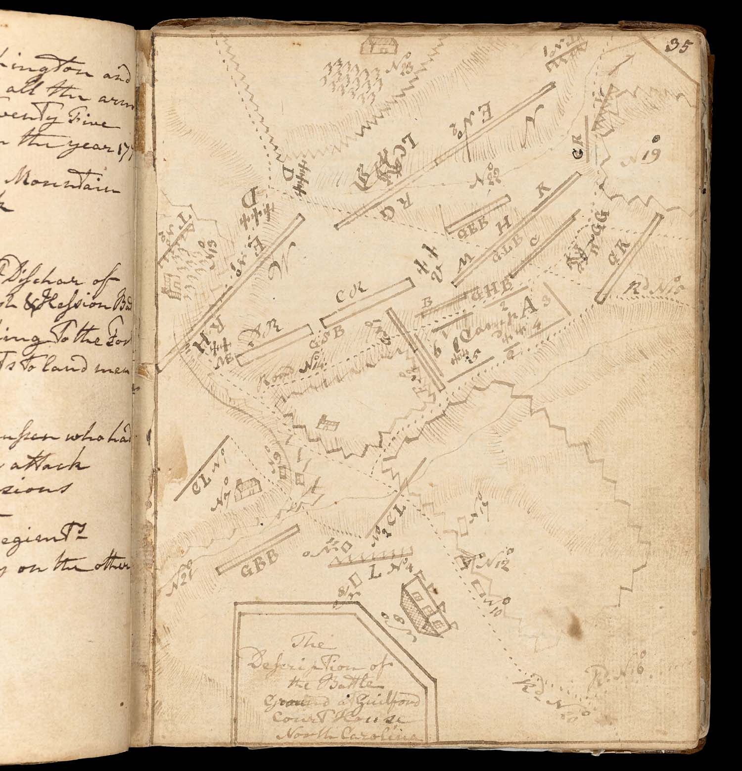
In 1781, Dr. Walter Bennett witnessed the battle of Guilford Court House in North Carolina. This map shows Lord Charles Cornwallis leading the outnumbered British forces to a victory against Major General Nathanael Greene. However, the battle cost Cornwallis more than a quarter of his men, and he was forced to withdraw from the Carolinas.
Walter Bennett
[Map of the Battle of Guilford Court House]
A Book of Memorandums and Remarks with Notes and Observations and Receipts on Various Occasions
1758-1781
Manuscript
Osher Collection
The London Gazette was the most significant source of information for the English people. But it was also widely distributed in America and informed both sides of the latest developments. Intended to present the “progress” of the British army, this map shows General Howe’s landing, the battle at Flatland on Long Island, the fleet invasion of New York City, the battle at White Plains and the retreat of the “rebels.”
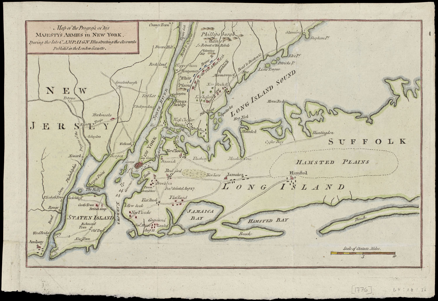
Map of the Progress of His Majesty’s Armies in New York
London: The London Gazette, 1776
Copper Engraving
Smith Collection
In September of 1775, Colonel Benedict Arnold led the Continental Army from Cambridge, Massachusetts on an expedition to Quebec City. The resulting Battle of Quebec failed, and was the first major American defeat of the war.
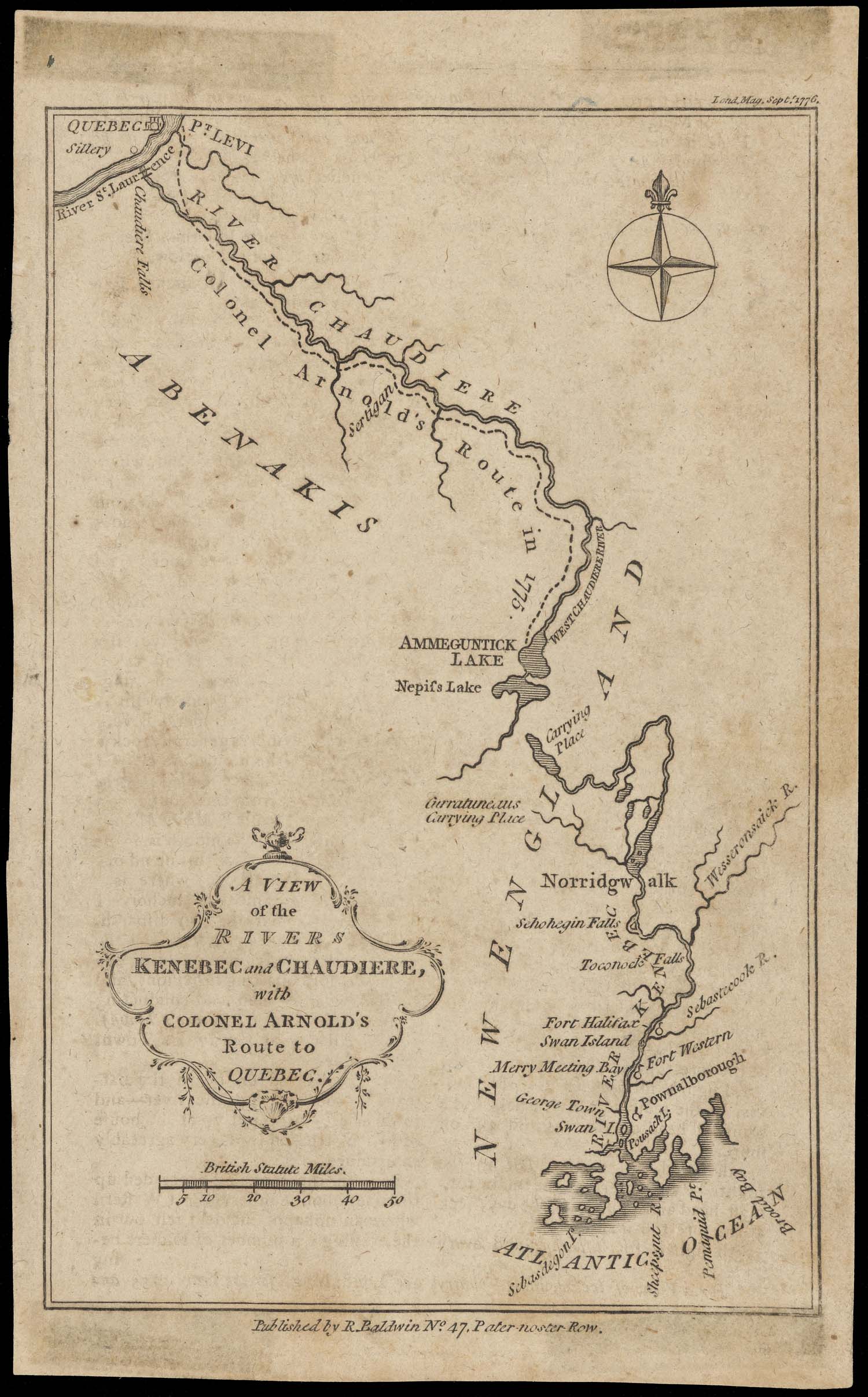
A View of the Rivers Kenebec and Chaudiere, with Colonel Arnold’s Route to Quebec
London: London Magazine, 1776
Copper Engraving
Osher Collection
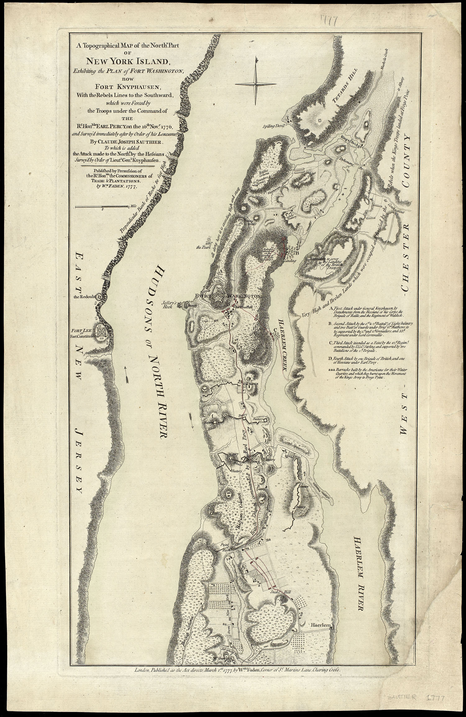
“Exhibiting the Plan of Fort Washington, Now Fort Knyphausen, with the Rebels Lines to the Southward.”
William Faden
A Topographical Map of the Northn. Part of New York Island
London, 1777
Sheet Map
Smith Collection
“From the Observations of Lieut. Page of His Majesty’s Corps of Engineers; and from the plans of other Gentlemen.”
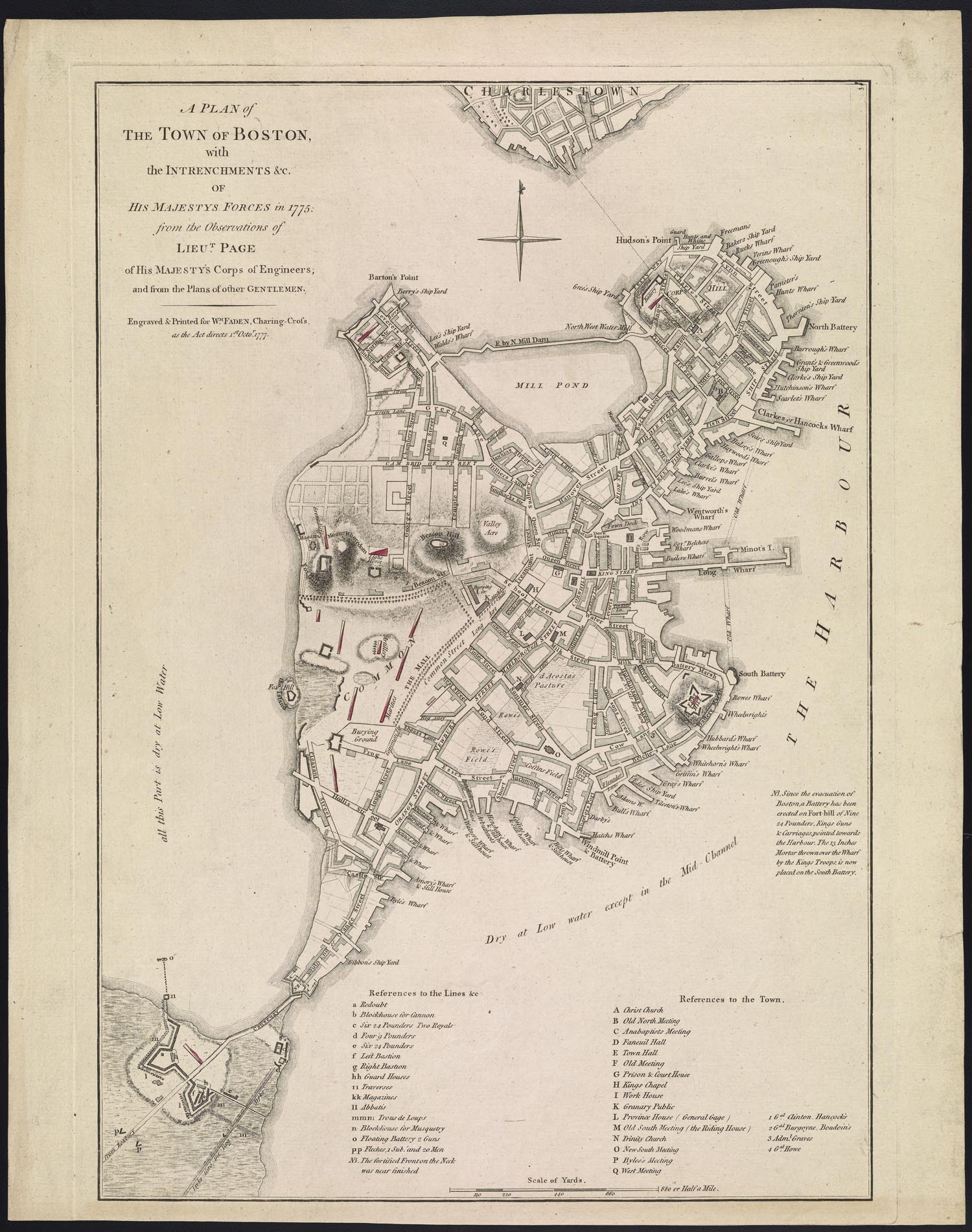
Sir Thomas Hyde
A Plan of the Town of Boston, with the Intrenchments and of His Majesty’s Forces in 1775
1777
Sheet Map
Osher Collection
”with the Rebels Works raised against the Town in 1775, from the Observations of Liet, Page of His Majesty’s Corps of Engineers, and from the Plans of Capt. Montresor.”
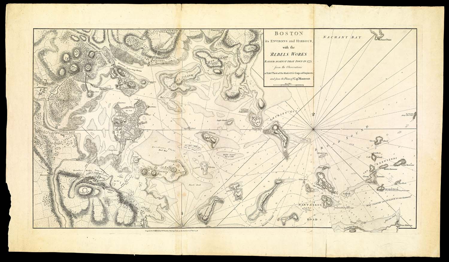
William Faden
Boston its Environs and Harbour London: Thomas Hyde, 1777 Sheet Map Smith Collection