

John Green
A Map of the most Inhabited part of New England
London: Thomas Jefferys
Sheet Map
Osher Collection
“containing a historical, political, and commercial view of the English settlements including all the countries in North-America, and the West-Ideas, ceded by the peace of Paris by Mr. Wynne”
John Huddlestone
A General History of the British Empire in AMerica
London: W. Richardson and L. Urquhart, 1770
Sheet Map
Smith Collection
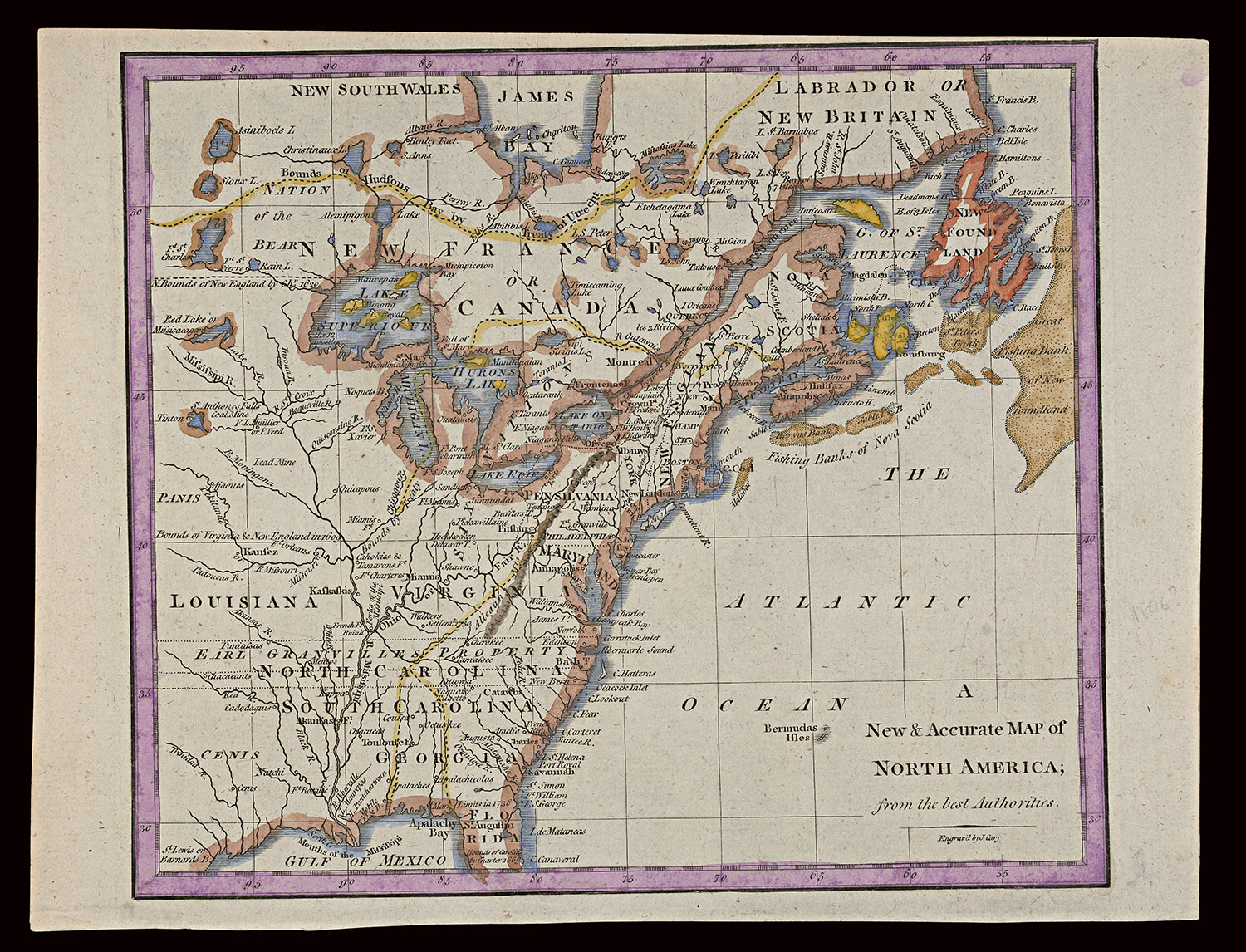
John Cary
A New and Accurate Map of North America; From the Best Authorities
1770
Sheet Map
Smith Collection
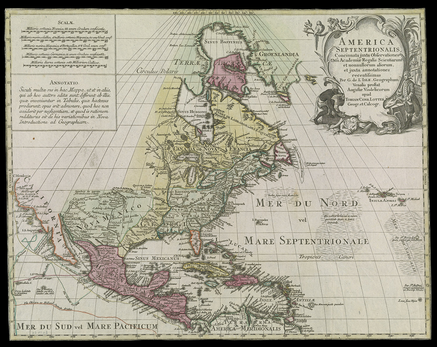
Guillaume Delisle
America Septentrionalis, Concinnata juxta Observationes Dnn Academiae Roalis Scientiarum
Ausburg: Tobias Conrad Lotter, 1772
Copper Engraving
Smith Collection
“with part of Pensilvania, and New England, from an actual survey by Captain Montressor, engineer, 1775. P. Andrews, sculp.”
John Montresor served as the Chief Engineer to Sir William Howe’s army. During the Revolution he was stationed in Boston. He wrote in his journal, “We are just now an army without provisions a rum artillery for Besieging; scarce any ammunition; no clothing, nor any money. Somewhat dejected by Burgoyne’s capitulation, and not elated with our late manoeubres, such as Donop’s repulse, and the Augusta and merlin being burnt and, (to complete all,) blockaded.”
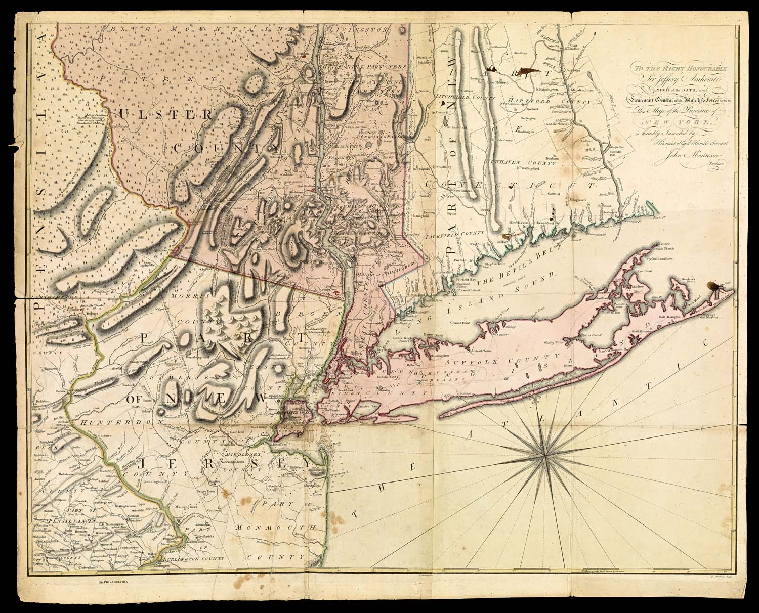
John Montresor
A Map of the Province of New York
London: Andrew Dury, 1775
Sheet Map
Osher Collection
“Containing Virginia, Maryland, the Delaware counties, Pennsylvania and New Jersey, with the addition of New York and the greatest part of New England as also of the bordering parts of the province of Quebec, improved from several surveys made after the late war, and corrected from Governor Pownall’s late map, 1776.”
This map, from the American Military Pocket Atlas, was used by the British to expand westward toward French settlements.
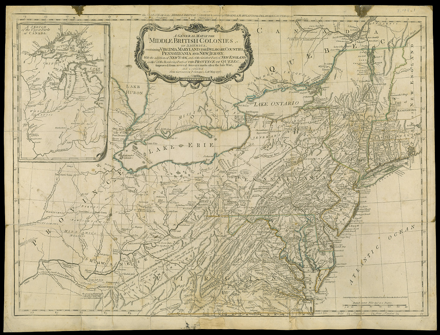
A General Map of the Middle British Colonies, in America
London: John Bennett and Robert Sayer, 1776
Copper Engraving
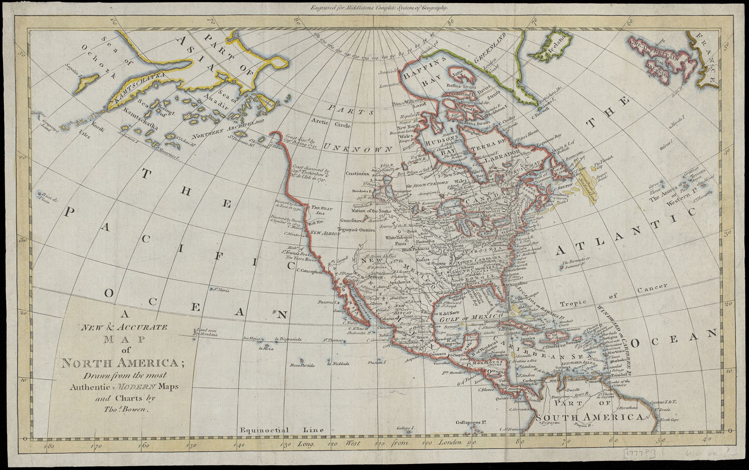
Thomas Bowen
A New and Accurate Map of North America; Drawn from the Most Authentic Modern Maps and Charts
1777
Sheet Map
Smith Collection