
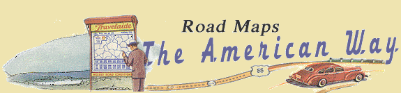
The citizens of the United States have perhaps been the most mobile people in the world. After the Civil War, railways dominated long-distance transportation until the development of bus companies and commercial airlines in the 1930s. Personal mobility was, of course, greatly expanded by the bicycle late in the 1800s. These forms of transportation - together with subways and ferries - all produced their own maps to aid navigation and to attract customers.
Maps for bicyclists are among the earliest forms of road maps, as pedal power preceded the automobile. Scaled to serve the "century cycle" (100 miles in a day), they often came in a guide booklet sized to fit the pocket [65, 66, 67]. Landmarks important to the cyclist, such as rail lines and steep slopes, are shown. The best routes are printed in red and keyed to the booklet.

Maine Road Book.
Boston: George H. Walker and Company, 1898

Massachusetts Road Book.
Boston: George H. Walker and Company, 1898.

Latest Road Map of New Jersey: Northern Part.
Boston: George H. Walker and Company, 1905.
Railroad maps date to the nineteenth century and are among the most colorful of the transportation maps [68, 69]. Like road maps, railroad maps were as much advertisement as geographical reference: the rear panels of 69 argued that rail is superior to the automobile as form of transportation in urban areas;70 promoted the railway as a means to enjoy landscapes from the comfort of the railroad coach (or "car"), providing both geological and historical information; 71 was a flyer produced to attract investment in a new railroad; 72 promoted easy access for tourists to the scenic mountains of Alaska and British Columbia. The characteristic design element of railroad maps, as seen on 71 and 72, is the compression of place names onto the rail line so that the routes resemble fir branches.

Tourist Map of Canada.
Chicago: Poole Brothers for Canadian National Railways, 1936.
**No Image available**

The Railway all the Way to the New York World's Fair.
N. Y. W. F., 1939.

Barnard, Chris.
Four-Track Series, No. 31: Seen from the Car, Travel as a Fine Art.
Chicago: Rand McNally, 1902.

Map of Canadian Rockies and the Triangle Tour of British Columbia, Alaska and The Yukon.
Chicago: Poole Brothers for Canadian National Railways, 1927.
Long distance bus routes, such as those represented on a 1939 Greyhound map [73], are necessarily small-scale and highly generalized. By contrast, city bus routes are shown in large-scale and with great detail to assist the rider in finding a destination in the urban maze [74].

Greyhound Transcontinental Bus Time Tables.
The Greyhound Corporation, 1939.

Guide Map: Street Cars and Bus Lines.
Washington, D.C.: Capital Transit, 1946.
The automobile always had one particular advantage in its competition with the railroad and the bus: it was private, not communal. The motorist was not bound to preset routes and schedules. The automobile was therefore portrayed as the ultimate form of transportation [75]. But the railroad and bus - as well as the airplane - gave the automobile a run for its money, as is demonstrated by the several maps produced to guide people to the 1939 World's Fair by each form of transportation [69, 70, 76, 80]. The downside of the automobile, however, was the need for state and other police officers to ensure that we do not abuse that personal mobility [77].

Road Map and Historical Guide: Ohio, Indiana, Kentucky.
Chicago: Rand McNally and Company for Sun Oil Company, 1936.

World's Fair, New York 1939.
New York: General Drafting Company for Socony-Vacuum Oil Company, 1939.

Official Map 1934 State Highways of Ohio.
Columbus: State of Ohio, Department of Highways, 1934.
The earliest airplane maps had the same strip format as the earliest road maps, guiding pilots between the landmarks on their route from city to city. This same format was used by the fledgling Air France in 1930, but this time to indicate ground-surface landmarks to passengers flying from Paris to Bucharest [78]. American Airlines followed a few years later with the more familiar, small-scale, "crow-fly" routes. Only macro ground features were shown and competing forms of transportation were ignored [79, 80].

La Rougery, Blondel, editor.
Paris- Bucarest: Carte de Route.
Paris: Air France, 1930.

American Airlines System Map.
Chicago: General Drafting Company for American Airlines, 1950.

The World's Fair Line, Comprehensive Map Showing the Commercial Air Transport System of the United States.
Chicago: The H. M. Gousha Company for American Airlines, Inc., 1939.
On some occasions it becomes necessary to go under or over. The subway map thus becomes a unique type: color-coded, abstract, and almost one-dimensional. Connections, express service, and hours of operation are of more concern than how one reaches the station or finds a specific destination [81]. Bridge and ferry companies distributed maps intended to guide traffic to routes that would increase their toll revenues. They received support from tourist and other commercial businesses en route [82, 83]. And for the times when the water surface serves as the road, oil companies provided popular cruising charts and guides, again free of charge [84].

New York Subway Guide.
New York City Transit Authority, 1974.

Cross the Delaware at Chester, PA: Avoid Philadelphia Traffic.
Chester- Bridgeport Ferry Company, 1937.

Lake Champlain Bridges: All Year - Day and Night - No Delays.
Crown Point, New York: Lake Champlain Bridge Commission, 1939.

Crossing Guide: Eastport, Maine to Barnegat Inlet, New Jersey including Long Island Sound.
Chicago: Rand McNally and Company for Socony Mobil Oil Company and affiliates Magnolia Petroleum Corporation and General Petroleum Corporation, 1947.