
From war-time welders, fishermen's wives, and net makers to fishpackers, pilots and boardinghouse keepers, Staying the Course explores the diverse roles and stories of the women involved in the maritime commerce of Portland from both historical and contemporary perspectives, and is a premier collaboration of Maine Maritime Museum and Osher Map Library. Opens at the Portland Public Library’s Lewis Gallery on First Friday, August 7, 2015 at 5 pm.
- More about this exhibit:
- Portland Public Library
- Maine Maritime Museum
- Staying the Course Brochure
Exhibitions Maps
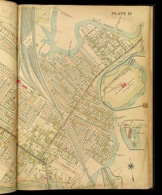
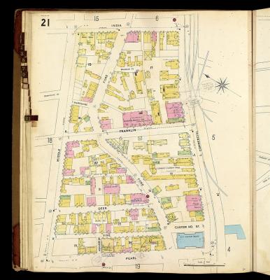
Map of Waterfront Area in Portland, Maine
From: Richards Standard Atlas of the City of Portland
Authorities: Richards Map Company
Publisher Location: Springfield, MA
Item Date: 1914
Item Description: 1 atlas: [1], 23 double plates including 63 colored maps
Item Height (cm): 58
Barcode: 2982
Accession No: OML-1914-33
Lc Call No: G1219.P8 R5 1914
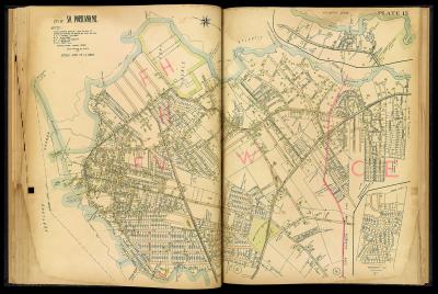
Map of Waterfront Area in South Portland, Maine
From: Richards Standard Atlas of the City of Portland
Authorities: Richards Map Company
Publisher Location: Springfield, MA
Item Date: 1914
Item Description: 1 atlas: [1], 23 double plates including 63 colored maps
Item Height (cm): 58
Barcode: 2982
Accession No: OML-1914-33
Lc Call No: G1219.P8 R5 1914
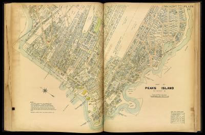
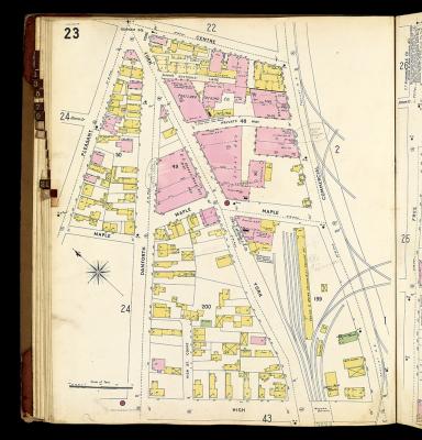
Map of Waterfront Area on Peaks Island, Maine
From: Richards Standard Atlas of the City of Portland
Authorities: Richards Map Company
Publisher Location: Springfield, MA
Item Date: 1914
Item Description: 1 atlas: [1], 23 double plates including 63 colored maps
Item Height (cm): 58
Barcode: 2982
Accession No: OML-1914-33
Lc Call No: G1219.P8 R5 1914
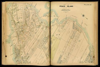
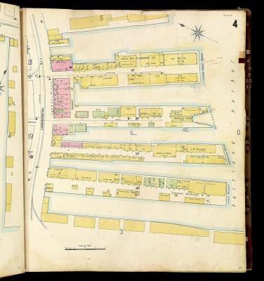
From: Insurance Maps of Portland, Maine
Authorities: Sanborn-Perris Map Company
Published in: New York
Region: Portland (part of)
Item Date: 1896
Item Height (cm): 65
Barcode: 11483
Accession No: OML-1896-21
From: Insurance Maps of Portland, Maine
Authorities: Sanborn-Perris Map Company
Published in: New York
Region: Portland (part of)
Item Date: 1896
Item Height (cm): 65
Barcode: 11483
Accession No: OML-1896-21
From: Insurance Maps of Portland, Maine
Authorities: Sanborn-Perris Map Company
Published in: New York
Region: Portland (part of)
Item Date: 1896
Item Height (cm): 65
Barcode: 11483
Accession No: OML-1896-21