
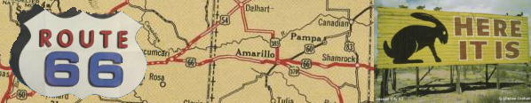
The United States is a land covered with roads, criss-crossing their way from the Atlantic to the Pacific, from Canada to Mexico. Through the years, certain roads have come to hold special meaning due to the events that have taken place along them, the great distances they cover, and the attractions that sit alongside them. Perhaps no road has been so mythologized by Americans as Route 66, the path that stretched from Chicago to Los Angeles.
Route 66 existed as an officially commissioned road for less than 60 years--from 1926 to 1985--but in that time it became a symbol for the freedom of the open road, the magic of auto travel, and the potential that lies in the American West. Economic hard times, marketing strategies, and popular culture all worked together to make Route 66 into a legendary road, one that has continued to hold deep meaning for many--even some who never traveled it--a quarter century since its closure.
This web presentation was developed by Lucinda Hannington for ANE 670, Museums and Public Culture, taught by Prof. Donna Cassidy in Spring 2011. It draws on materials in the Yorke, French, and Yenson collections of road maps in the Osher Map Library and Smith Center for Cartographic Education.
(c) Lucinda Hannington (text and design), University of Southern Maine (images), 6 June 2011.