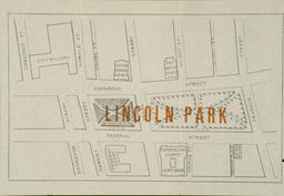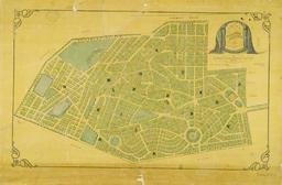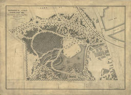
Phoenix Park, rededicated Lincoln Park in 1909 as shown on this map [51], was the city's first formal park. It was built as a fire break after the great fire in the midst of what was then one of the city's densest neighborhoods. The park featured a central fountain, formal walking paths, and an ornamental cast iron fence [52].
Lincoln Park
Smith & Sale, Printers. 1909
From: The Dedication of Lincoln Park ....
February 12, 1909 in observance of the one hundredth
anniversary of the birth of Abraham Lincoln.
Lithograph, 20 x 33 cm
Courtesy of Earle G. Shettleworth, Jr.
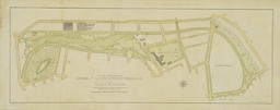
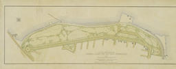
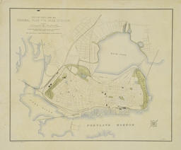
The three maps in this grouping [53, 54, 55] represent the work of talented engineers in the employ of the city as it directed its expansion towards Back Cove and Deering. They were commissioned by Mayor James Phinney Baxter and completed by the Olmsted and Olmsted firm in 1905. They envisioned the future of Portland's parks system along with detailed plans for the Eastern and Western Promenades. While the promenades pre-date the park movement with carriage roads laid out as early as 1837, neither was developed fully as a park until the late nineteenth century.
General Plan for the Western Promenade
From: James P. Baxter, The Park System of Portland
(Portland, 1905)
Boston: Heliotype Printing Co., 1905
Heliotype, 19 x 52 cm
Osher Collection
This 1869 plan for Evergreen Cemetery illustrates one of the city's first excursions off the peninsula. Needing more burial space for its growing population, it founded Evergreen Cemetery in what was then Westbrook. Burials actually began in 1854.
Charles R. Goodell
Map of Evergreen Cemetery
After a photograph by M. F. King
Portland: John Russell,1869
J. Mayer & Co. Lithography
Lithograph, 39 x 63 cm
This plan for Deering Oaks is an especially elegant example of city engineer William Goodwin's drafting skills and design sensibilities. His initial vision of the park was largely executed, although later plans by the Olmsted firm modified his work. Much of Deering Oaks was given to the city in 1879 by members of the Deering, Preble and Fessenden families. Other parcels were added over the next forty-four years.
Goodwin, William A.
Deering Oaks
1879, pen and ink on linen
Reduced facsimile
Courtesy of Portland Public Works Dept.
This map shows the extent of green space in Portland today. It was prepared by Richard D. Kelly, Jr. to accompany a book published by Greater Portland Landmarks titled, Bold Vision: The development of the parks of Portland, Maine.
Richard D. Kelly, Jr.
Plan of Parks and Open Spaces, Portland, Maine, 1999
Reduced facsimile from Bold Vision, T. Holtwijk and E.G. Shettleworth, Jr., editors
Portland: Greater Portland Landmarks, 1999


