

Moses Greenleaf (1777-1834) was Maine’s pioneer mapmaker. An outspoken advocate of Maine statehood and economic development, he prepared his first map in 1815 [map 7] to accompany his demonstration that Maine deserved independence: A Statistical View of the District of Maine (Boston: Cummings and Hilliard, 1816). This map was the first to depict the interior lakes and rivers of Maine with any degree of accuracy. Greenleaf’s 1820 reissue — the first map of the State of Maine — shows improvements in the delineation of several features, including Moosehead Lake [8].

Moses Greenleaf
Map of the District of Maine from the Latest and Best Authorities
Boston: Cummings & Hilliard, 1815
Engraving, hand-colored; two sheets, 101cm x 65.5cm combined
Thompson, no. 27 — State I
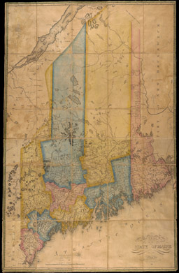
Moses Greenleaf
Map of the State of Maine from the Latest and Best Authorities … 1820
Boston: Cummings & Hilliard, 1820
Engraving, hand-colored; two sheets, 101cm x 65.5cm combined
Thompson, no. 28 — State II
Greenleaf continued to promote the settlement and development of Maine’s interior after 1820. Nine years later, he published, as a set, his 460-page Survey of the State of Maine in Reference to its Geographical Features, Statistics and Political Economy (Portland, Me.: Shirley and Hyde, 1829), a large wall map that greatly expanded the interior detail while emphasizing the uncertainty of Maine’s northern boundary [map 9], and a small atlas [11-12, in the central floor case]. The atlas, only the third state atlas produced in the United States, makes a clear argument. Its first four maps graphically explain the U.S. position over the boundary with Lower Canada and disprove the British claims [12]. Two maps offer a cartographic display of Maine’s population growth, and the final plate of meteorological data shows how climatically suitable Maine was for further development. After Greenleaf’s death, his son updated and republished the large wall map, probably to help pay off debts incurred by his father. Moses Greenleaf III incorporated the results of the 1842 Webster-Ashburton Treaty, but mislabeled the new northern boundary with Canada as “Boundary as fixed by the Treaty of 1843” [11]. This unique map colored Aroostook County with its “intermediate” boundaries of 1842-1843. A final version of the wall map in 1844 corrected the date error and shows the County’s final boundaries.

Moses Greenleaf
Map of the State of Maine with the Province of New Brunswickv Portland: Shirley & Hyde, 1829
Engraving; four sheets, 127.5cm x 103cm combined
Thompson, no. 31 — State I
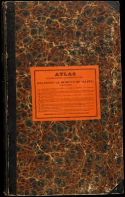
Moses Greenleaf
Atlas Accompanying Greenleaf’s Map and Statistical Survey of Maine
Portland: Shirley & Hyde, 1829
Thompson, no. 30

Moses Greenleaf
Map of the Principal Rivers, Mountains and Highland Ranges of the State of Maine
In Atlas Accompanying Greenleaf’s Map and Statistical Survey of Maine (Portland: Shirley & Hyde, 1829), plate 1.
Engraving, hand-colored; 54cm x 33cm
Thompson, no. 30-a