
An advertisement for the Cleveland Union Terminal opening, this stunningly designed pictorial map positions the city as the new powerhouse of the industrial Midwest. From all points of the compass, Great Lakes ships, steam trains, trucks, buses, automobiles, and airplanes head toward the gleaming new terminal.
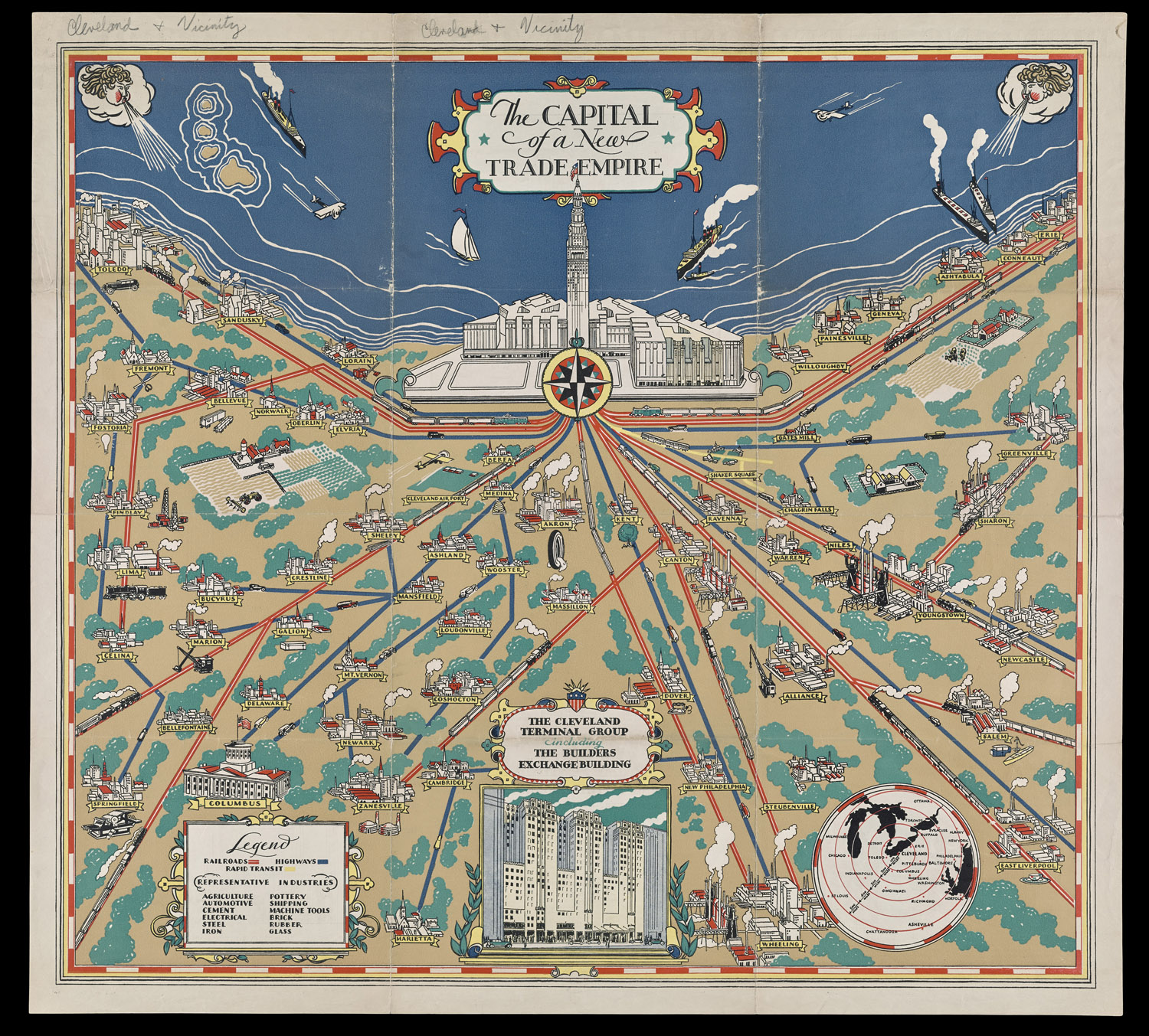
19. Cleveland Terminal Group, The Capital of a New Trade Empire (1929).
Stephen J. Hornsby Collection
URL: www.oshermaps.org/map/4000167
Pictorial Maps Landmarks Search Letter Clue: J
--> View Map in New Window
Pan American Airways produced several pictorial maps advertising its various international services. This one captures the glamour of the Clipper Ship seaplanes and their exotic destinations in Latin America.
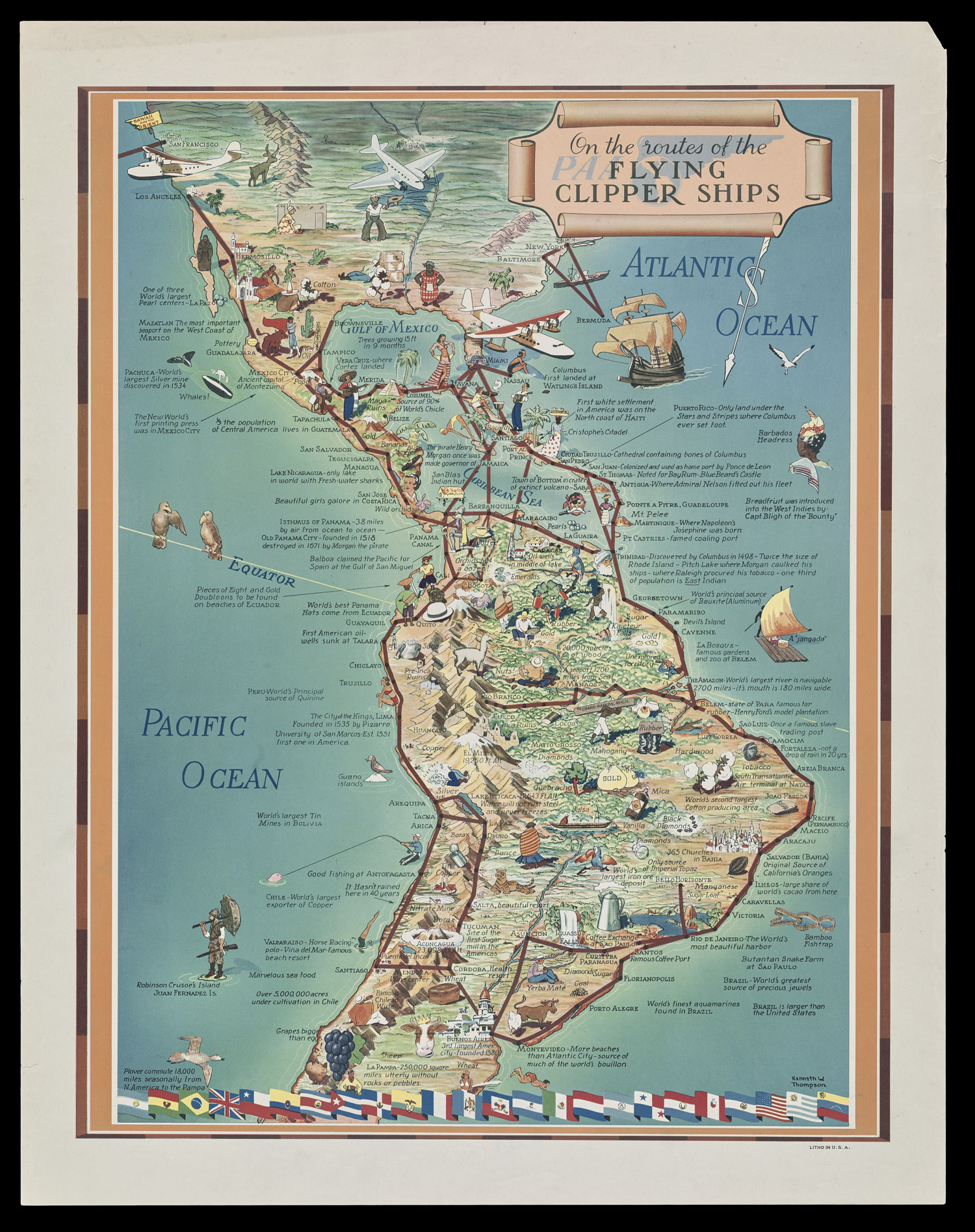
20. Kenneth W. Thompson, On the Routes of the Flying Clipper Ships (ca. 1939).
Stephen J. Hornsby Collection
URL: www.oshermaps.org/map/4000168
Pictorial Maps Landmarks Search Letter Clue: G
--> View Map in New Window
The Public Works Administration commissioned this map to celebrate the New Deal. The map displays a great variety of construction projects, soil conservation, and education and health programs.
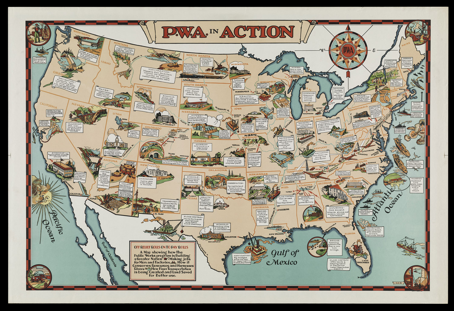
21. C.H.W., P.W.A. in Action (ca. 1935).
Stephen J. Hornsby Collection
URL: www.oshermaps.org/map/4000169
Pictorial Maps Landmarks Search Letter Clue: R
--> View Map in New Window
Advertising Michigan's largest bakery and the first in the United States to introduce "Hollywood Diet Bread," this pictorial map has much in common with brag maps produced about the same time (see E.S. Hammack, "Greater!" Los Angeles and the Rest of the United States as Seen thru the Sun-Kissed Glasses of a Los Angeleno). Full of fun, the map includes a serenading Mexican singing, "I gotta da gal from Kalamazoo." This may be the only map that has loaves of sliced bread as border decoration!
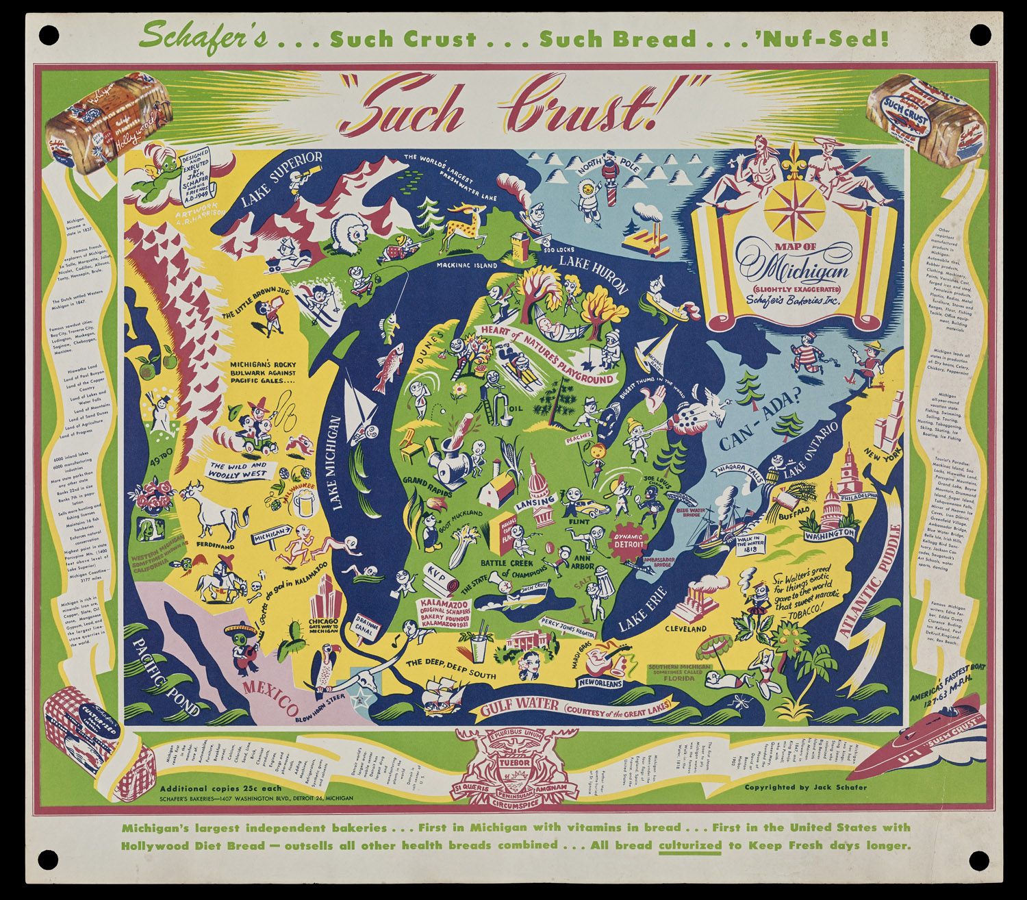
22. Jack Shafer, Map of Michigan (Slightly Exaggerated) Shafer's Bakeries Inc. (1949).
Stephen J. Hornsby Collection
URL: www.oshermaps.org/map/4000170
Pictorial Maps Landmarks Search Letter Clue: K
--> View Map in New Window