
The use of pictorial elements has a long history in European mapping. Early modern mapping featured a great deal of “decoration,” especially in the margins. In this 1662 world map, Joan Blaeu illustrated the heliocentric cosmos whose elements are represented by Classical gods. The orbits of the planets, shown as rings of cloud, circle Apollo, the Sun god: Mercury, Venus, the Earth itself, Mars, Jupiter, and Saturn; the Moon is nestled between the Earth’s two hemispheres. Across the bottom of the image, Blaeu included illustrations of Flora, Demeter, Bacchus, and Senex as allegorical representations of Spring, Summer, Autumn, and Winter.
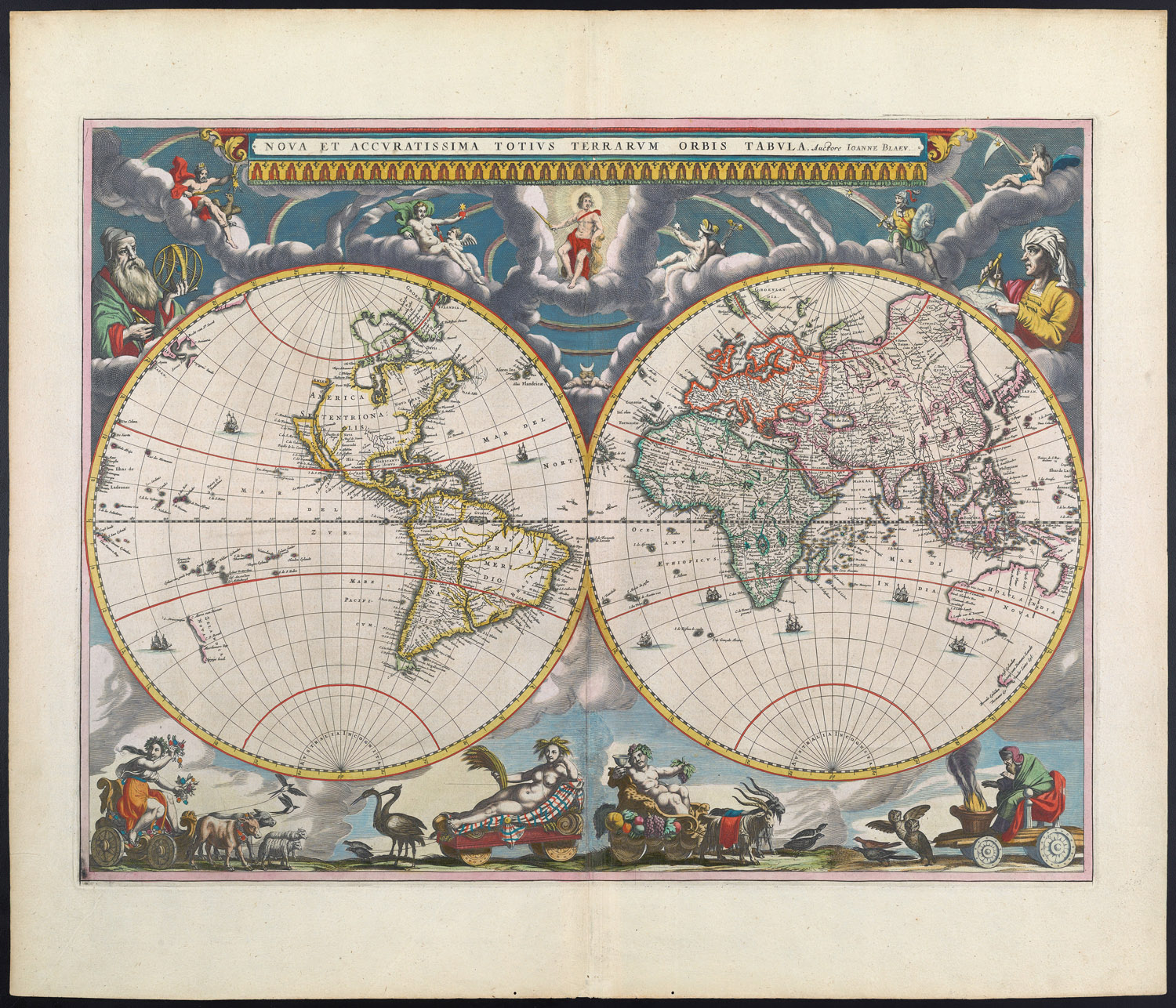
Joan Blaeu, Nova et accuratissima totius terrarum orbis tabula (1662).
Osher Collection
URL: www.oshermaps.org/map/458
Pictorial Maps Landmarks Search Letter Clue: S
--> View Map in New Window
The nineteenth century popularized the high-altitude panorama or bird’s-eye view, perspectives that would be widely used in twentieth-century popular mapping. This view looking down on the summit of Mount Washington was published by the Passenger Department of the Boston and Maine Railroad as both an enticement to tourists and a memento of a visit to the crowning jewel of northern New England. While the scene appears as if viewed from the gondola of a hot air balloon or blimp hovering above the summit, the notable peaks and locations of the White Mountain region are illustrated in 360 degrees, a startling deviation from the traditional Birds-Eye-View.
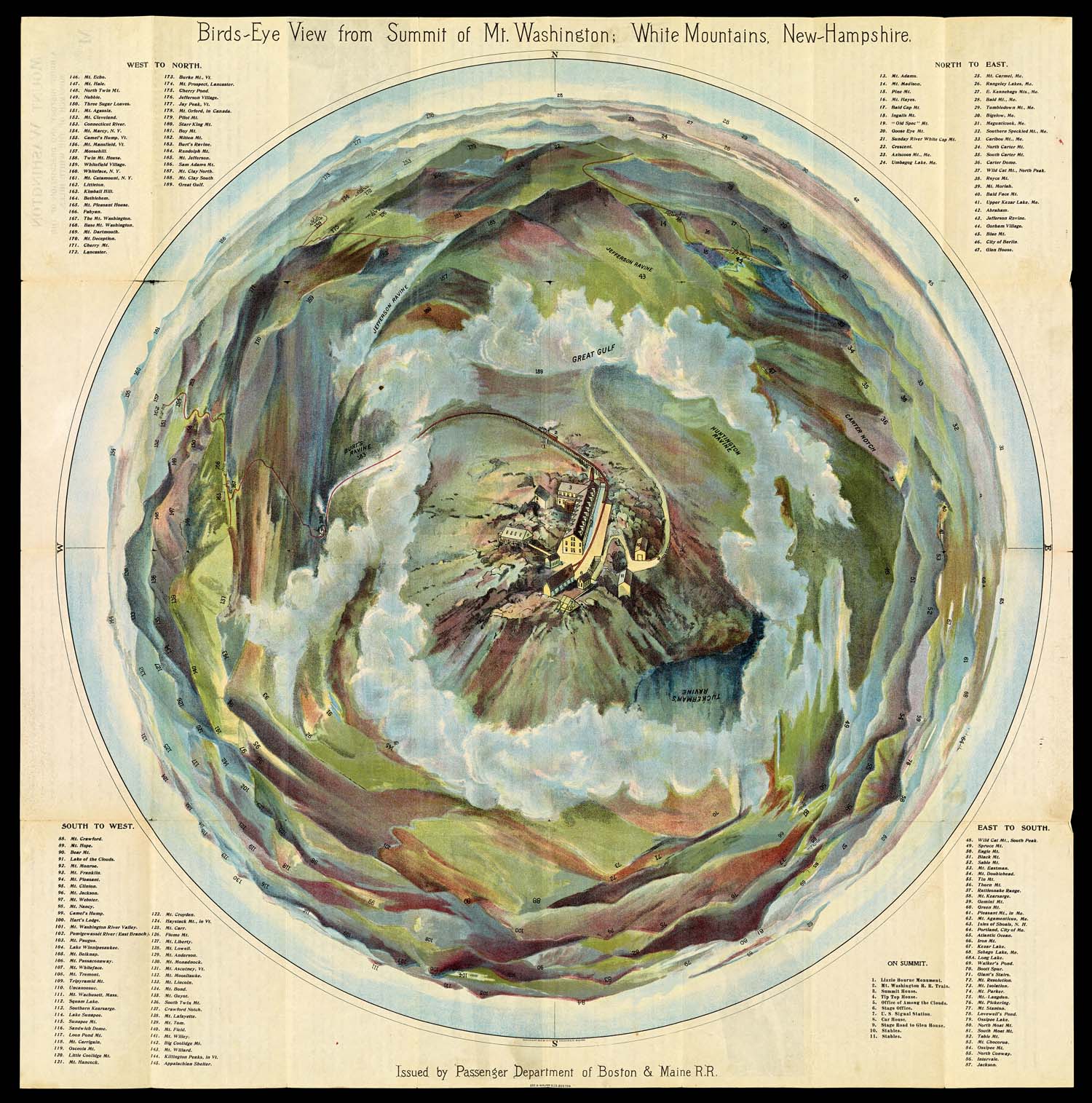
1. George H. Walker & Co., Birds-Eye View from Summit Mt. Washington (ca. 1905).
Osher Collection
URL: www.oshermaps.org/map/40687
Pictorial Maps Landmarks Search Letter Clue: W
--> View Map in New Window
This late example of a bird's-eye view was titled "pictorial map," explicit recognition of the close affinity between bird's-eye views and pictorial maps. The handwriting on the map provides information about Fresno and surrounding area, perhaps to entice the recipient of the map, who lived in Racine, Wisconsin, to move to California.
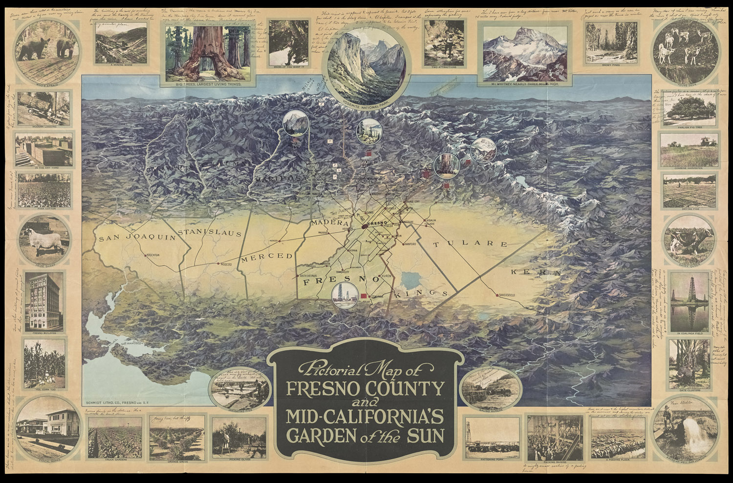
2. Anonymous, Pictorial Map of Fresno County and Mid-California's Garden of the Sun (ca. 1920).
Stephen J. Hornsby Collection
URL: www.oshermaps.org/map/4000155
Pictorial Maps Landmarks Search Letter Clue: U
--> View Map in New Window
Commissioned by London Underground, Gill's colorful Wonderground Map was the most influential of all twentieth-century pictorial maps. Originally produced as a large poster for London Underground stations, the map became so popular that London Underground reproduced the map in a smaller size (as in this example) for sale to the general public. By the 1930s, copies were being retailed in the United States.
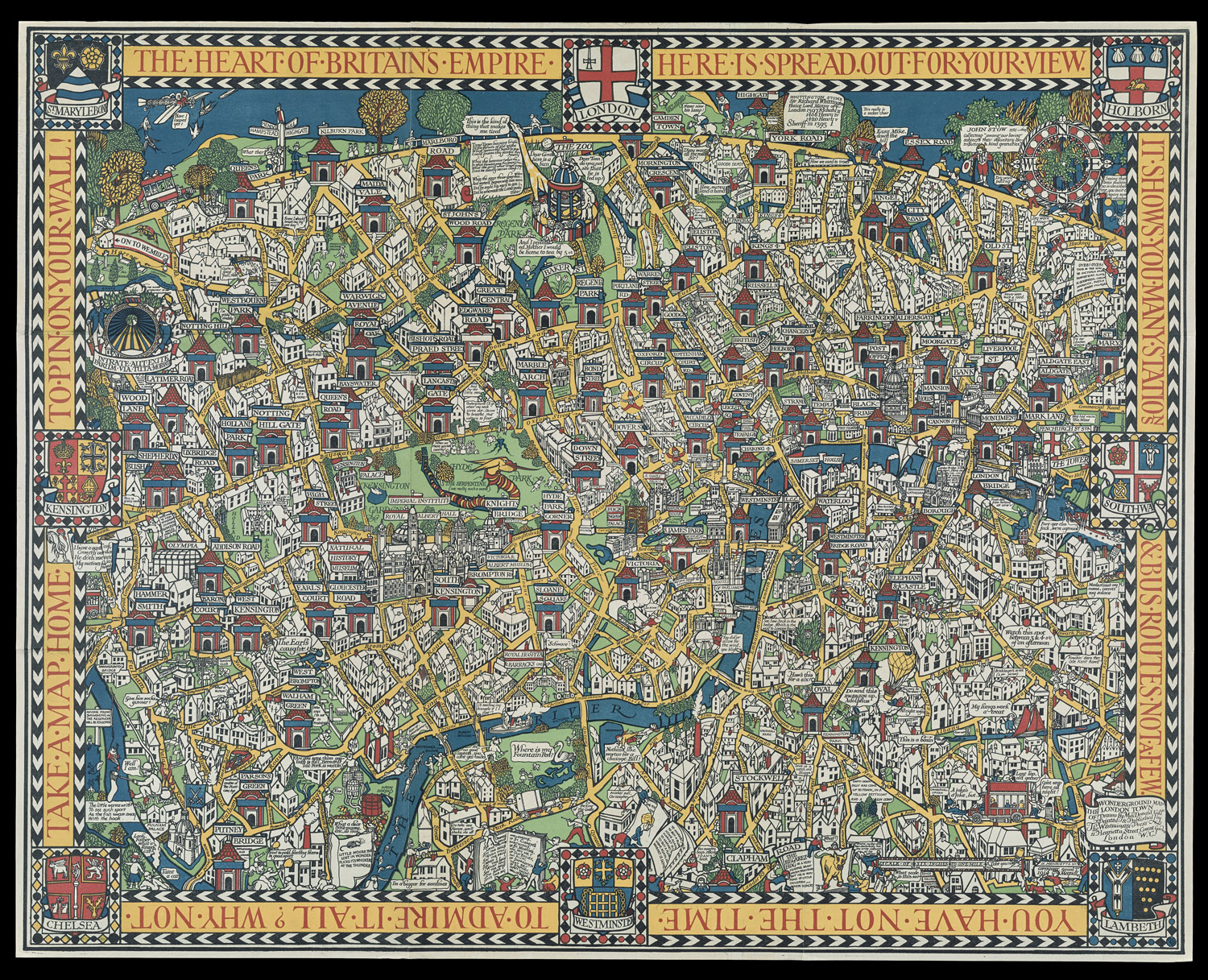
3. MacDonald Gill, Wonderground Map of London (1914, 1927 ed.).
Stephen J. Hornsby Collection
URL: www.oshermaps.org/map/4000156
Pictorial Maps Landmarks Search Letter Clue: T
--> View Map in New Window
The well-known Boston publishing house Houghton-Mifflin commissioned three pictorial maps from Olsen and Clark in 1926. The Boston map was followed by maps of Philadelphia and Washington, DC. The Boston map shows the clear influence of MacDonald Gill's Wonderground Map. Color palette (particularly yellow for roads), text balloons, and cartoon buildings are all highly derivative of Gill's map. Nevertheless, the Boston map was one of the first brightly colored pictorial maps produced in the United States and had an immediate stimulus on the growth of the American pictorial map genre.
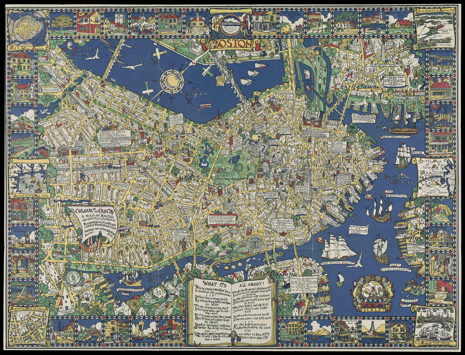
4. Edwin B. Olsen and Blake E. Clark, The Colour of an Old City: A Map of Boston (1926).
Stephen J. Hornsby Collection
URL: www.oshermaps.org/map/4000157
Pictorial Maps Landmarks Search Letter Clue: O
--> View Map in New Window