“By repetition, the shape of the map of the continental United States has entered the national collective image bank. . . . The shape of the United States is so ingrained in the minds of those who live here (and probably in the minds of a great part of the rest of the world’s population, too) that it stands for the nation as a symbol.”
Nigel Holmes, Pictorial Maps (1991), 47.

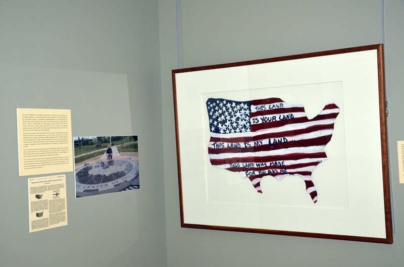
John Sperry. This Land is Your Land (ca. 2001). Tin and acrylic paint, 32 x 58 cm.
The Stars and Stripes was designed with thirteen stars and thirteen alternating red-and-white stripes to represent the original thirteen states that had formed the union in 1776; two more stars and two more stripes were added in 1795, for Kentucky and Vermont. To prevent the flag from turning into a peppermint stick as new states were admitted, the U.S. Congress proclaimed in 1818 that the stripes would be limited to thirteen, but that new five-pointed stars would be added to represent each new state. Our familiar fifty-star flag has been used since Alaska and Hawaii joined the Union in 1959.
Lyrics from popular patriotic songs such as America the Beautiful (1910), by Katherine Lee Bates and Samuel A. Ward, and God Bless America (1939), by Irving Berlin, are routinely published in conjunction with the outline map motif. In this instance the artist has formed sheet metal into the shape of the United States, over which he has painted the flag and added words from This Land is Your Land (1940), Woody Guthrie’s critical response to Berlin’s song.

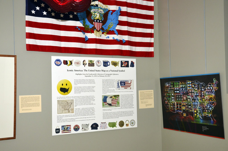
Eagle and Stars and Stripes Beach Towel. 75 x 151 cm.
Michael Bierut. American Smile. Illustration for The Atlantic, 2007. Facsimile.
Nam June Paik. Electronic Superhighway: Continental USA (1995). Smithsonian American Art Museum. 51 x 92 cm. Reduced Facsimile.
Ushapia maps come in all sizes ranging from pins smaller than a postage stamp to monumental multimedia installation measuring forty feet long and fifteen feet high. Nam June Paik (1932-2006) created that enormous map in 1995 by arranging 336 televisions on a scaffold in the shape of the U.S.A., which he then overlaid with some 600 feet of neon tubes. Fifty DVD players send multimedia simultaneously to the screens populating each state while different colors for individual states highlight their distinct cultural identities. Audio clips from old movies and flashing images complete the virtual experience of traveling cross-country via electronic media. The work is on permanent display at the Smithsonian American Art Museum in Washington, D.C., which acquired the complete archive of this Korean-born artist in 2009. Paik is recognized as a technological genius who transformed video into an artist’s medium by inventing new tools to realize his multimedia vision.

