
Making Maps Intellectually Accessible. Maps are complex: they are shaped by social attitudes and cultural beliefs. To understand old maps we must therefore do more than relate their content to modern maps; we must also read “between the lines.” A good way to start doing so is to consider how “decorations” actually convey specific meanings within the map’s overall image. (See also section X.)
The three eighteenth-century maps in this section — one French (item 1), one British (item 2), and one Dutch (item 3) — supplement the geographical outlines of the Americas with prominent decorative vignettes (or, small views). In particular, they all show the same vignette of beavers building a dam. What made this image so appealing and worth copying?
This vignette greatly magnified Europeans’ appreciation of the beaver as a model of hard work and natural skill. First, it imagined a well-orchestrated army of beavers, each identified as having a specific job; in this, it mimicked the carefully regulated division of labor that was by 1700 increasingly common in the construction of major public works. Second, it set the beavers’ work against the dramatic backdrop of Niagara Falls, whose size and splendor truly amazed Europeans.
The meaning of the vignette lies in the parallel readily drawn between these elements: the industry of the beavers in building dams, the efficiency of regulated work gangs, and the tremendous natural presence of the falls. Were Europeans to apply their industry in such a manner to American landscapes, the vignette suggests, they could construct new works of similar magnitude! This powerful sentiment converts otherwise strictly geographical images into ambitious images of empire.
Nicolas de Fer first published this map in 1698. It is one of the earliest maps to take the separate vignettes that were commonly pasted around the edges of large wall maps (see item 4) and incorporate them into the body of the map. Impressions of this map are quite rare; presumably it suffered, like all wall maps, from a high mortality rate. This particular version (state 3) was published in 1705. More information about this map is provided by Edward H. Dahl, “The Original Beaver Map: De Fer’s 1698 Wall Map of America,” The Map Collector, no. 29 (1984): 22-26.

Nicolas de Fer (1646-1720)
L’Amérique, divisée selon l’étendu de ses principales parties {America, divided according to the extent of its principal parts} ([Paris], 1698|1705)
Copper engraving (with some etching) in four sheets, with hand-applied water-color, mounted on linen; 106cm x 117cm
Osher Collection
The vignettes on De Fer’s wall map were probably designed and engraved by Nicolas Guérard. He derived the background of the beaver vignette -- at the upper left of the wall map -- from the first published image of the falls, in Jean-Louis Hennepin’s 1697 account of his travels. The foreground depicts an imaginary army of beavers who, through the careful division of labor, are constructing a dam. Each beaver is identified by task: lumberjacks (A), carpenters (B), masons (I), and lesser laborers (C, D, G, L) do the hard work, supervised by a “commandant or architect” (E) and other officers, such as the “inspector of invalids” (F) who ensures that disabled beavers really are injured and not malingering.
Transcription of the vignette’s key
Des Castors du Canada Leurs Industrie a Bâtir des Chaussées pour retenir l’Eau se faire d’un Petit Ruisseau un Grand Lac, pour y construire Leurs Logements au tour, est tout a fait merveilleuse.
- A. Bucherons qui avec leurs Dents couppent de Gros Arbres qu’ils font tomber a travers le Ruisseau pour Servir de fondement a leurs Chaussées
- B. Charpentiers qui Couppent les Branches de longueur
- C. Porteurs de Bois pour la Construire
- D. Ceux qui font du mortier
- E. Commendant ou l’Architecte
- F. Inspecteur des Invalides
- G. Ceux qui Trainent le Mortier par leurs Queües
- H. Castor Incommodé de la Queüe pour avoir trop Travaillé
- I. Massons qui Batissent la Chaussée
- L. Comme Ils tappent avec leurs Queües pour rendre la Massonnerie plus ferme
- M. Logement les Castors en Dôme ou four avec une Sortie sur Terre et une dans l’Eau
Translation of the vignette's key, by Prof. Nancy Erickson (Modern Languages & Literatures, USM)
Concerning the Beavers of Canada Their industry in building dams to retain water in order to turn a little stream into a big lake, in which to construct their lodges, is totally wonderful.
- A. Lumberjacks who cut Big Trees with their Teeth, which they fell across the stream to serve as the foundation for their dams
- B. Carpenters who cut the long branches
- C. Bearers of wood for construction
- D. Those who make the mortar
- E. Commandant or architect
- F. Inspector of the disabled
- G. Those who drag the mortar on their tails
- H. Beaver with a disabled tail from having worked too hard
- I. Masons who build the dam
- L. Those who tap with their tails to make the masonry firmer
- M. Beaver lodge in the form of a dome or kiln with an exit on land and another in the water
The beaver vignette is famous among map enthusiasts from its later reuse by Herman Moll for this two-sheet map of the British colonies in North America. Protected within the covers of the many editions of Moll’s atlas, The World Described (London, 1715-1732), this map survives in far greater numbers than does De Fer’s wall map. It is therefore Moll’s map that is known to collectors and dealers as “the Beaver Map.”
The decades of war against Louis XIV had finally ended in 1714, bringing many years of colonial uncertainty to an end. With its beaver vignette, Moll’s map calls for the expansion and intensification of Britain’s colonial efforts.
Moll incorporated several of De Fer’s vignettes on some of his other maps. Note that Moll’s engraver copied each directly from De Fer’s map onto the copper plate, so that when the map was printed the vignette was reversed.
In providing a commentary to the beaver vignette, Moll took the French key at face value: “A View of ye Industry of ye beavers of Canada in making Dams to stop ye Course of a Rivulet, in order to form a great Lake, about wch they build their Habitations. To Effect this: they fell large Trees with their Teeth, in such a manner as to make them come Cross ye Rivulet, to lay ye foundation of ye Dam; they make Mortar, work up, and finish ye whole with great order and wonderfull Dexterity. The Beavers have two Doors to their Lodges, one to the Water and the other to the Land side. According to ye French Accounts.”
This map is discussed by Dennis Reinhartz, The Cartographer and the Literati: Herman Moll and His Intellectual Circle (Lampeter, Wales: Edwin Mellen Press, 1997), 34-37 and 133-41.

Herman Moll (1654?-1732)
A New and Exact Map of the Dominions of the King of Great Britain on ye Continent of North America (London, 1715)
Copper engraving in two sheets, with hand-applied water-color; 102cm x 62cm
Smith Collection
The Châtelain family of Amsterdam book publishers produced a seven-volume Atlas historique [“Historical Atlas”] between 1705 and 1732. Each volume presented ornate maps together with extensive historical accounts and genealogies concerning each region of the world. Volume six (1719) contained this map as an introduction to a set of historical accounts (the “following dissertations” of the title). Although Latin was still the international language of scholarship, the Atlas historique was presented in French, by then the international language of culture and trade. This indicates that it was intended for northern Europe’s burgeoning middle classes. As befitting an instructional work, the atlas’s maps were not original compositions. In particular, Henri Châtelain slavishly copied this map from a now very rare, ten-sheet map published by Nicolas de Fer in 1713.

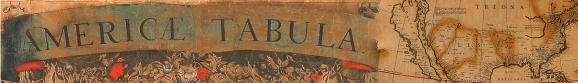
3. Henri Abraham Châtelain (1684-1743)
Carte tres curieuse de la mer du sud, contenant des remarques nouvelles et tres utiles … Le tout pour l’intelligence Des Dissertations suivantes {Map of the South Sea, that demands great attention, containing new and most useful remarks … All for the comprehension of the following dissertations} (Amsterdam, [1719])
Copper engraving in four sheets, mounted in two panels, with hand-applied water color; 82.5cm x 141cm
Osher Collection